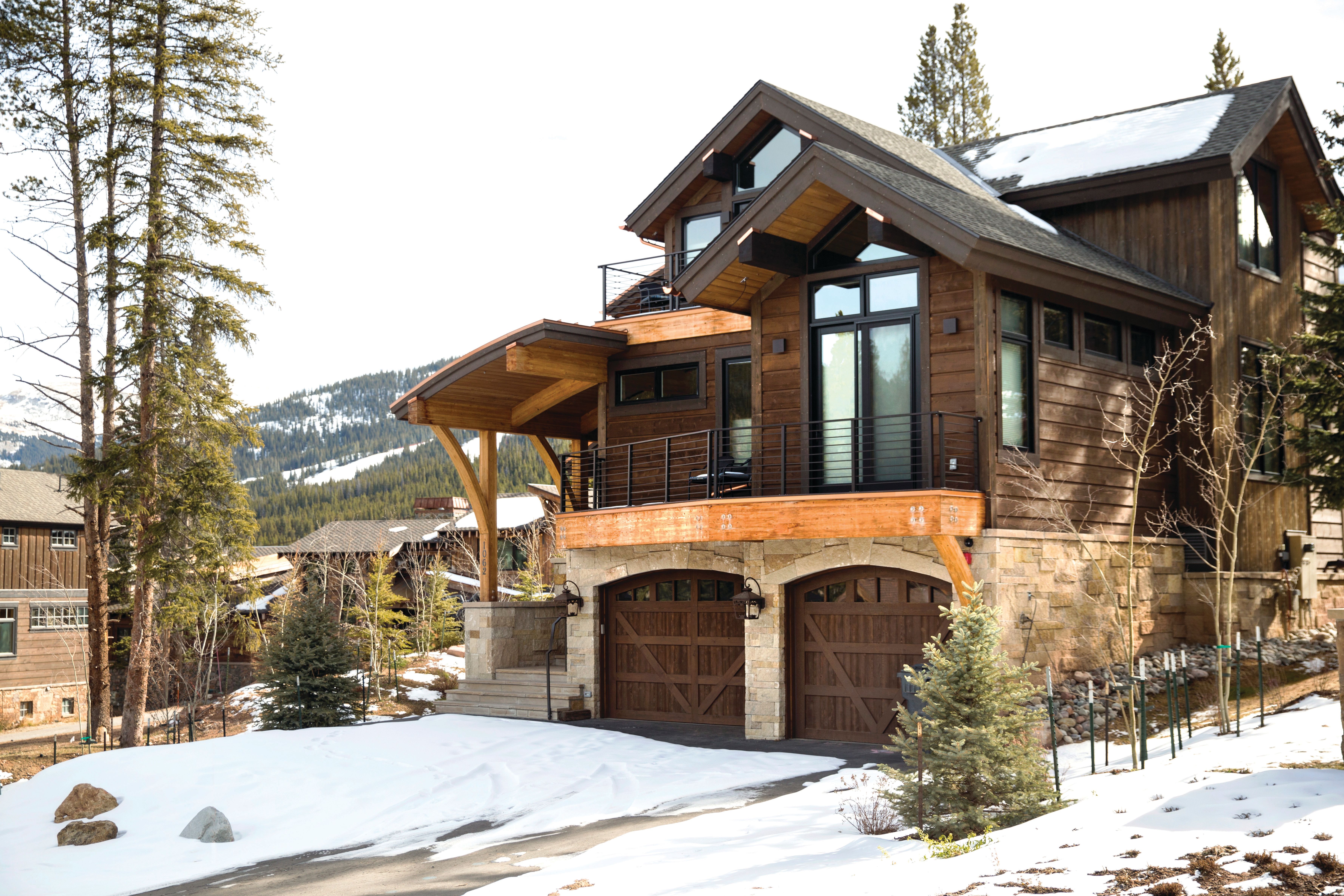
Article
A Divide to Conquer
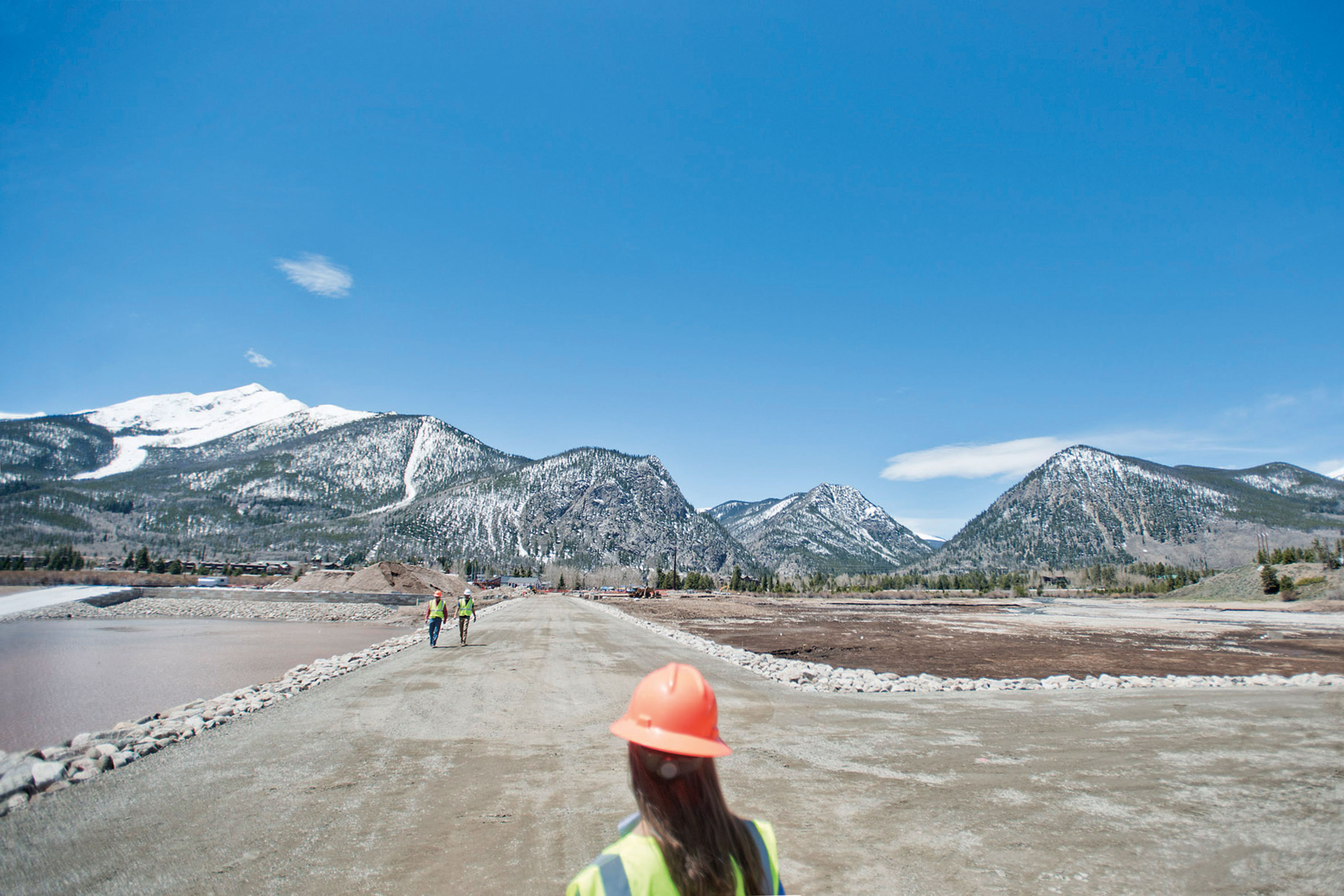
Signature sojourns along the crest of Summit's High Country for mountain and road bikers, leaf peepers, car campers, day hikers, backpackers, and anglers.
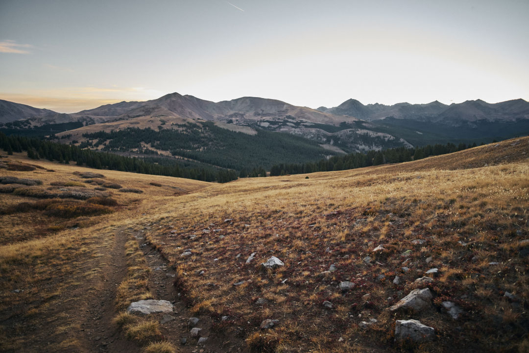
Image: Seth K. Hughes
The Continental Divide is best known as America’s backbone, an imaginary line that slices through the Rockies along high peaks and passes, separating the Atlantic and Pacific watersheds. Any drop of water that runs down the east side ends up in the Atlantic, while any water on the west side flows to the Pacific.
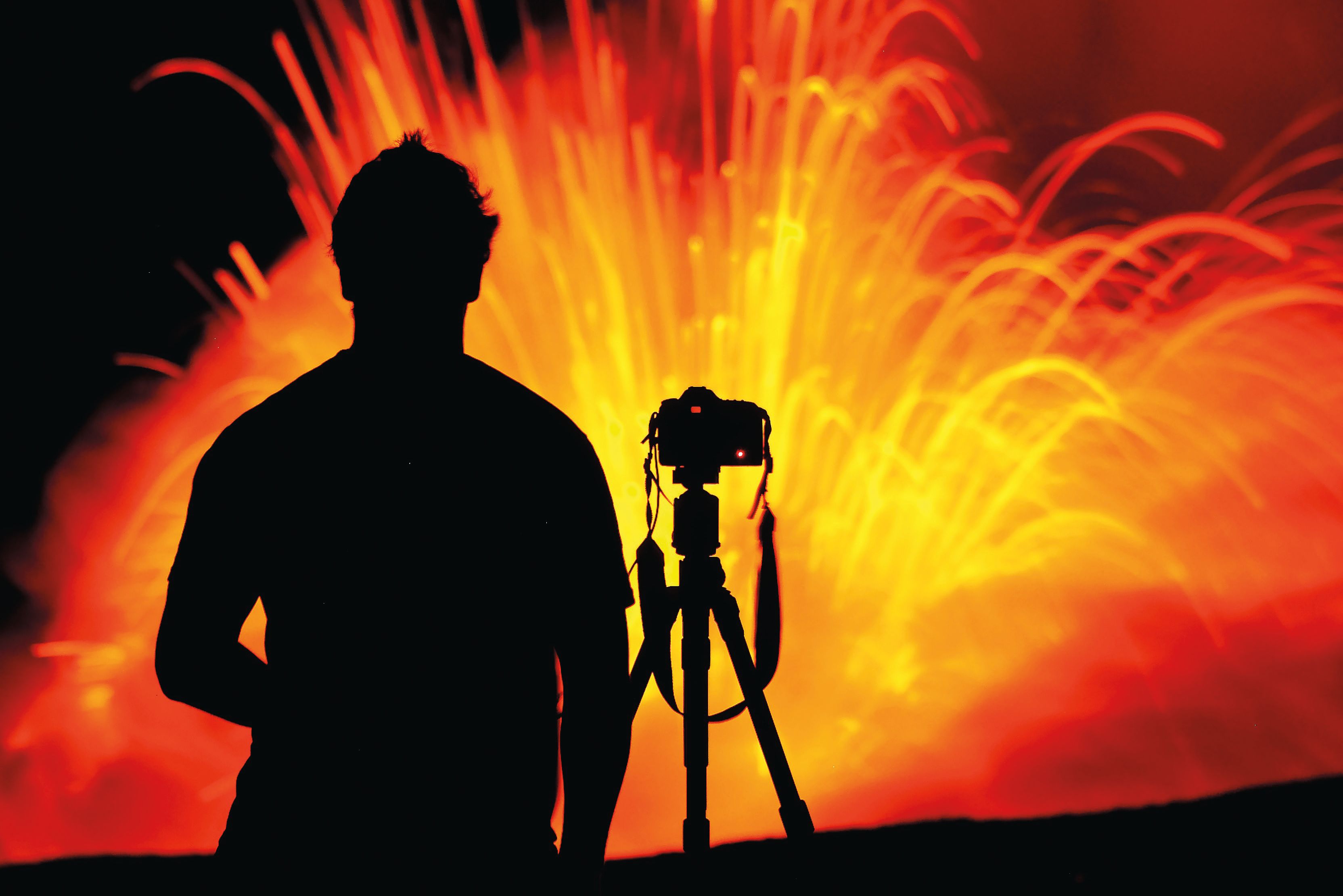
Summit County, like the nation, has long been defined by the Divide. When the county was founded in 1861, its border stretched from the Divide to the Utah and Wyoming state lines—a vast landscape that later was partitioned into seven counties. The Divide still serves as Summit’s eastern and southern borders in many places, and it or its namesake offshoots host a wide range of adventures, whether by foot, bike, horse, or vehicle. The Continental Divide National Scenic Trail (CDT), a 3,100-mile route from Canada to Mexico, slices through the heart of our county, bringing with it thru-hikers and bikers from around the world, fat-tire competitors taking on the annual Tour Divide race, and local adventurers who know how lucky they are to have the iconic trail in their backyard. The Great Divide itself crosses some of our premier topography, from lightly traveled Argentine Pass to popular peaks like Grays and Torreys. Whether you traverse it on two wheels, four wheels, or on foot, however you seek to experience the Divide, Mother Nature shall reward you, especially if you crib from our locally tested insider’s guide for outdoorspeople of every ilk.
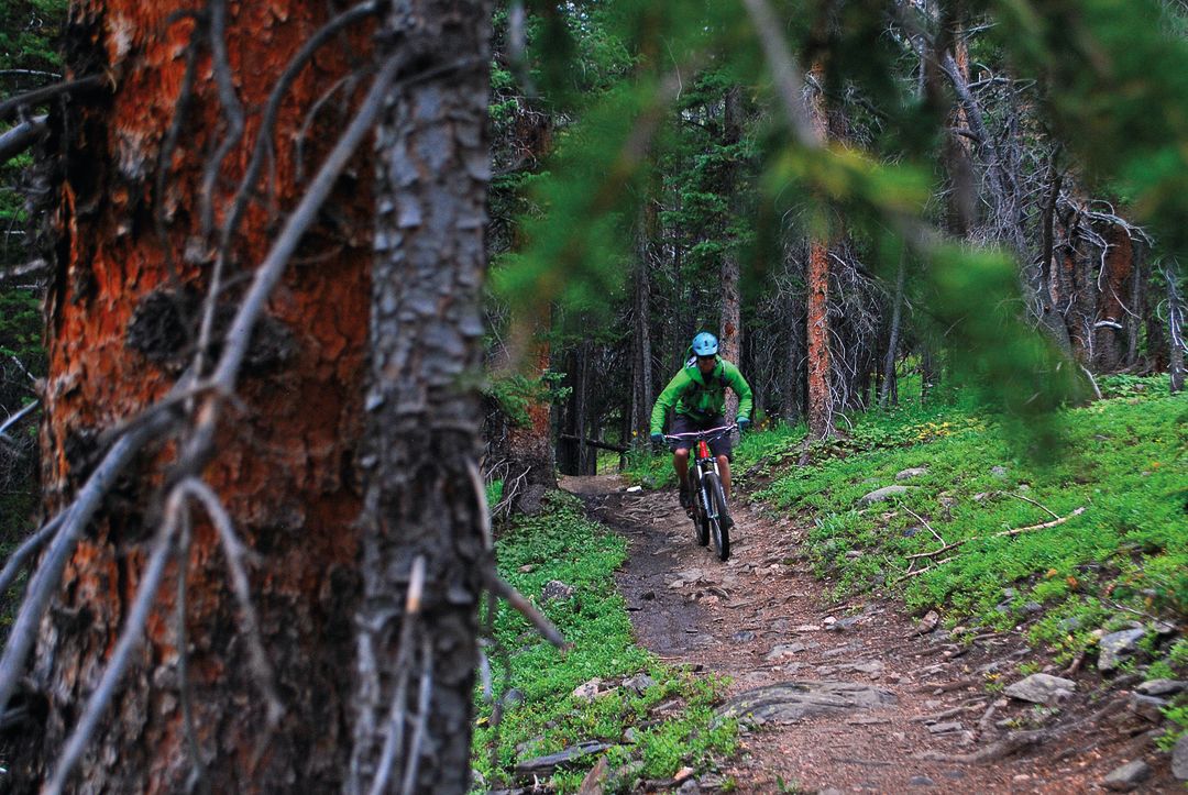
Image: Patrick Russell
For Mountain Bikers
Georgia Pass: A lot of Summit’s mountain biking is rugged and rocky. Georgia Pass (elevation: 11,585 feet) is an exception. Sure, it takes a lot to get there, but the moment you drop into the smooth ribbon of singletrack heading west on the Colorado Trail from the Divide, you forget about all that pain and anguish. Nothing matters except the eye-watering, make-you-drool descent into the Middle Fork of the Swan River. The only problem with this ride is, like a lot of places along the Divide, it’s a wee bit remote. You can ride it as an out-and-back (to do so, park on Tiger Road near Good Times) or come up from Michigan Creek to the south. Come fall, starting at Kenosha Pass along Highway 285 affords one of the prettiest foliage rides in the state.
French Pass: Perched on the Divide at 12,046 feet, French Pass separates Summit and Park counties between two signature 13,000-foot peaks: Bald Mountain, a.k.a. Baldy, and Mount Guyot. The grassy saddle is accessed by a stunning trail that starts at the end of French Gulch Road just east of Breckenridge and meanders up the valley. From late June through early August, this singletrack becomes a hallway through a kaleidoscopic wildflower array: purple, pink, red, orange, yellow, and blue. It is part of the locally-popular Circumnavigation of Mount Guyot, one of Summit’s signature mountain-bike loops, which many consider to be the queen stage of the Breck Epic, a backcountry cycling race where riders gain—and lose—40,000 vertical feet (you’ll find spectators handing out Skittles at the top of French Pass to weary racers; Aug 11–16, breckepic.com). You can also ride it as an out-and-back. Park at the Sallie Barber Trailhead; it’s 4.5 miles (and 1,600 vertical feet) to the pass from there.
Horseshoe Gulch
to Tiger Run: So, you don’t want to crest a mountain range or hurdle through rock gardens? This ride is for you. Start at the Dredge Boat Trailhead on Tiger Road and ride a few hundred yards past the pond to the junction with the CDT. Turn left and follow the undulating trail to the Swan River at Tiger Run. You can also incorporate the Blair Witch, Hippo, and Hay trails to add silky-smooth mileage and turn your ride into a lollipop loop.
Copper Mountain to Searle Pass: One of the prettiest local sections of the CDT climbs 6.2 miles from Copper Mountain’s western boundary to 12,034-foot Searle Pass. Wildflower lovers adore this trail. Though not always easy, almost all of it is rideable. You start with an undulating traverse across Copper’s frontside ski runs, then you exit the resort, cross a bridge, and start climbing alongside Guller Creek, a beautiful alpine valley full of wildlife and birdsong. Five hundred feet below Searle Pass you will pedal past Janet’s Cabin, a fine lodging option in summer as well as winter (see “For Backpackers,” p. 29). Of course, it is also a fine option to turn around at the pass and enjoy nearly 3,000 feet of descending back the way you came. Park in the overflow lot on the east side of Highway 91 just past the main Copper entrance, then join the trail near the lot’s southeast corner.
Tour Divide: The most famous competition involving the CDT is the Tour Divide, a solo, self-supported bike race that travels 2,745 miles between Banff, Alberta, and Antelope Wells, New Mexico. Average racers take three weeks. The record is 13 days, 22 hours, 51 minutes—an unbelievable average of 197 miles per day—set in 2016 by Mike Hall, a British rider who tragically was hit and killed by a car less than a year after he set the record. This summer, racers begin their journey in mid-June and are likely to pass through Silverthorne and Breckenridge 10–15 days later. More info: bikepacking.com/event/tour-divide-2019
For Road Bikers
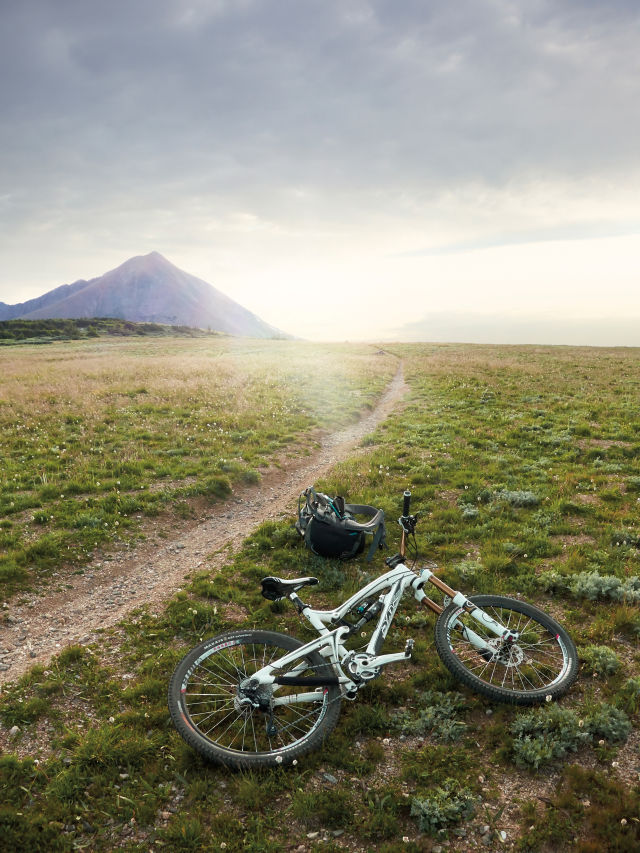
Image: Seth K. Hughes
Montezuma Road/Loveland Pass: Summit County roads aren’t known for their wide shoulders, even if our expansive recpath system makes it a palatable road-biking destination. One of the sweetest medium-size rides can be found on the northeast side of the county. Park in the River Run lot at Keystone, and head 6 miles up Montezuma Road to the small, funky town of Montezuma. Then retrace your pedal strokes back down the hill and along the Snake River to Highway 6. Turn right and begin the 8-mile, 2,500-foot grind up to Loveland Pass. It’s a classic for a reason: the scenery is unreal. On the Divide, zip up your windbreaker and take a sip from your water bottle—you’ll need every bit of focus for the thrilling descent back to your car.
Hoosier Pass: On the south end of the county, there is only one choice when it comes to spinning skinny tires up to the Divide. Hoosier Pass (elevation: 11,542 feet) isn’t the steepest climb, but your legs will confirm that it never lets up once you leave Breckenridge. The 11-mile (one way) ride on Highway 9 takes you through the quiet bedroom community of Blue River, underneath 14,265-foot Quandary Peak, then up a series of switchbacks to the pass. Park your bike and behold the expansive view, then head back to town for a burger and beer at Breckenridge Brewery.
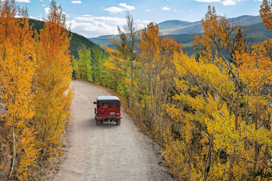
Image: Liam Doran
For Sunday Drivers and Leaf Peepers
Boreas Pass: Summit County doesn’t offer many classic fall-foliage drives, but that only makes Boreas Pass Road stand out more. The 6-mile dirt track from Baker’s Tank Trailhead to the pass—a.k.a. the Continental Divide—cruises along the western flank of Bald Mountain. Because it began as a railroad grade between once-bustling Como and still-bustling Breckenridge, it remains relatively flat throughout, climbing just 175 feet per mile. Which makes it the perfect place to take it slow and enjoy the extraordinary view to the west—while, of course, tunneling through an aspen grove that turns orange and gold each September. Pick up Boreas Pass Road at the four-way intersection on the south end of Breckenridge Main Street.
Loveland Pass: Before the Eisenhower Tunnel was built in 1973, the fastest way to Summit County from Denver involved driving over 11,990-foot Loveland Pass, another paved high point on the Divide. Even though Interstate 70 is faster, Loveland is still a classic—and among the most scenic asphalt cruises anywhere. Start heading uphill at Keystone, take a quick hike at the top of the pass (if it’s not too windy), then pit-stop at Pass Lake as you descend back toward Arapahoe Basin.
Wheeler Lake Road: Just over the border in Park County, Wheeler Lake Road affords as much fun as you can have in a high-clearance 4WD vehicle. This route is not for novices, but if you know how to handle yourself on crawler terrain, head south on Highway 9 over Hoosier Pass (which marks the Divide), then turn right on County Road 4 and take that to Montgomery Reservoir. Wheeler Lake Road starts just above the ramshackle Magnolia Mill and continues west below 14,286-foot Mount Lincoln and 13,614-foot North Star.
For Car Campers
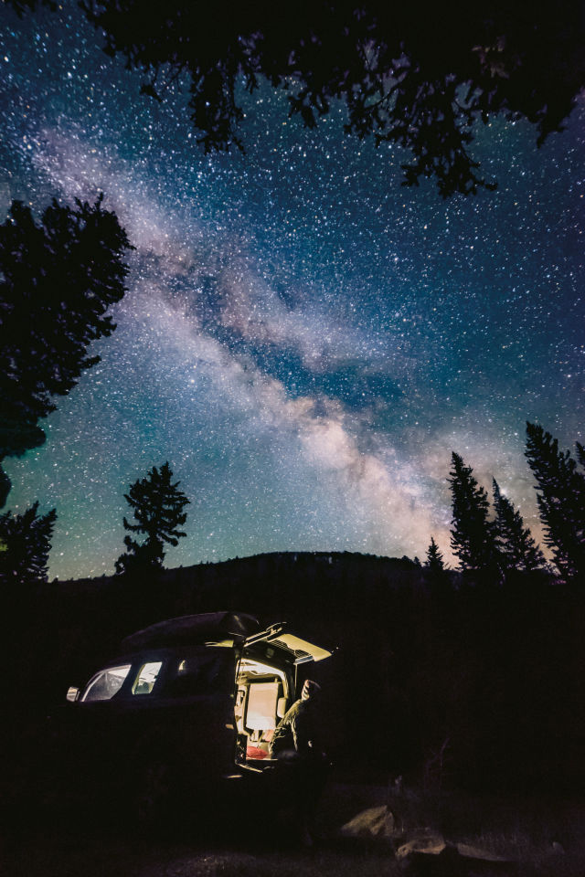
Image: Morgan Hatsukami
Hoosier Pass: There aren’t many places on the Divide where you can (legally) pitch a tent and enjoy all the comforts of car camping. But you can do just that off Highway 9 on Hoosier Pass, where a dirt road leads west from the parking lot and is immediately marked by fire rings and dispersed campsites on US Forest Service land. Nights get chilly at 11,500 feet, even in the heart of summer; but stargazing from our nation’s backbone makes the chill worth it.
Tiger Road: One of the best, and only, local car-camping zones adjacent to the CDT runs along Tiger Road northeast of Breckenridge. From Tiger Road’s junction at Highway 9 just south of Tiger Run Resort, head east for 4 miles to Muggins Gulch Road. Soon after you pass Muggins Gulch on your left, you’ll see a swath fit for tents and trailers on your right—conveniently located next to the freshly rechanneled Swan River. If you continue up Tiger Road, you can also find good camping by turning left up the North Fork of the Swan or staying straight toward Good Times Adventure Tours and the Middle Fork. Sites are first come, first served—and don’t forget to pack out your trash (and anybody else’s) and leave the site cleaner than you found it.
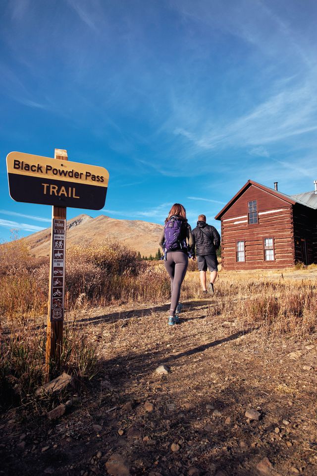
Image: Seth K. Hughes
For Day Hikers
Black Powder Pass: Given the high number of visitors to Boreas Pass, it’s surprising how few of them venture east to Black Powder Pass—a beautiful and reliably empty trek between Bald and Boreas mountains. The 3.4-mile trail starts at the Section House, an old boarding house for railroad workers that was built in 1882, shortly after the route got upgraded from a wagon trail over the Divide. The trail to Black Powder can be loose at times, but the view from 12,159 feet, especially toward Park County to the east, is hard to beat. Simply drive to Boreas Pass and start hiking.
Grays and Torreys: The highest point on the entire CDT is the 14,270-foot summit of Grays Peak. Grays makes up one half of the classic combo that includes its partner to the north, Torreys. The twin summits are separated by a .7-mile saddle that dips 500 vertical feet, requiring just enough energy to reach the next peak that you feel like you actually have hiked two different mountains. Park at the Stevens Gulch trailhead off the Bakerville exit off I-70, or, if you want to start and end in Summit County, park in Peru Creek near Montezuma and ascend via Grays’ lesser-traveled southwest ridge.
Gold Hill: This section of the CDT might be the best family hike in Summit County. During wildflower season, bushels of columbines gird the trail as it climbs gently west through an open hillside, affording expansive views of the Tenmile and Gore ranges. Kids will enjoy ample logs and stumps to rest and play on. Parents will enjoy the serenity. The route also makes for a smooth trail run and connects to the Peaks Trail if you want more mileage. Find the trailhead on Highway 9 halfway between Frisco and Breckenridge.
Chihuahua Gulch: Sometimes it’s more spectacular to gape at the Divide than to travel along it. Such is the case with Chihuahua Gulch, a towering natural amphitheater that branches off from Peru Creek Road outside Montezuma and leads to a trout-filled turquoise lake. Torreys’ tall rock pyramid looms high above to the east, while a near-vertical cirque to the north and west makes you feel like you’re in Yosemite National Park. The cirque also separates Chihuahua Gulch from Arapahoe Basin Ski Area, where a growing trail network provides another great place to hike below the Divide. To get to Chihuahua from Keystone’s River Run Village, follow Montezuma Road for 1.7 miles to County Road 260/Peru Creek Road; follow that road east for 2.2 miles, then watch for the trail on your left.
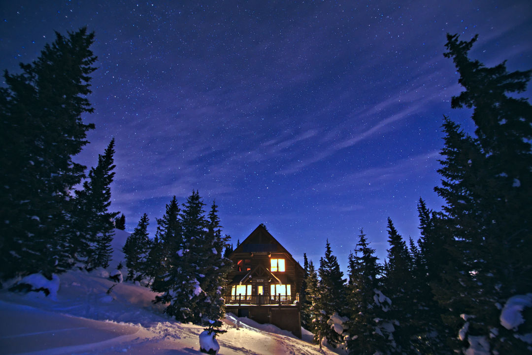
Image: Andrew Reinberg
For Backpackers
Janet’s Cabin: The oldest refuge in the Summit Huts system, Janet’s was built in 1990 and has been one of the most popular huts in Colorado ever since. It sits just off the CDT in a vast alpine meadow filled with flowers. Though not as busy in the summer as it is in the winter, the 3,000-square-foot log cabin is no less warm and welcoming—especially on days when the skies unleash their classic late-afternoon thunderstorms. Instead of shivering in a soggy tent, you can watch the tempest through a window as a fire crackles in the wood stove. Or, to do so from a perch that your weary muscles might appreciate more, take a seat in the sauna before enjoying a hot meal. More information can be found at summithuts.org, and you can book a spot at Janet’s (beds cost $43/night) by calling 970-925-5775.
Miners Creek Trail: High above Frisco, on your way to the crest of the Tenmile Range, the Miners Creek Trail meanders through a series of lush drainages with ample campsites nestled beneath Tenmile Peak and Peaks 3 and 4. You may encounter some hardy souls bike-packing this trail—which is not surprising since it doubles as the CDT—but the best way to do it is on foot. That’s because much of the trail is rugged and rocky, even below tree line. The trail crosses a number of creeks and meadows that house potential sites to pitch a tent and enjoy the alpenglow above the toothy skyline. Start at the Lower Miners Creek Trailhead (off Miners Creek Road just south of the County Commons in Frisco), and hike a couple of miles up the dirt road to where the singletrack begins (you can also drive up the rugged road and start at the upper trailhead to save your legs). If you can handle a big climb, turn it into a point-to-point adventure and continue on the Wheeler Trail to Copper, then take the free Summit Stage bus back to Frisco.
CDT Fun Facts
- The Continental Divide Trail was established by an act of Congress in 1978 and traverses five states along the spine of the Rocky Mountains: Montana, Idaho, Wyoming, Colorado, and New Mexico.
- It is the highest and most remote of the United States’ 11 National Scenic Trails.
- An average 3,100-mile thru-hike from the border of Mexico to Canada takes six months, which requires the hiker to complete an average of 17 miles a day.
- Given the rugged remoteness of the terrain, only a third of those who attempt a thru-hike are successful.
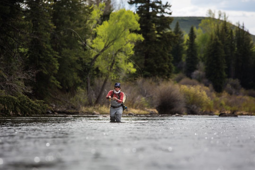
Image: Liam Doran
For Anglers
Tenmile Creek: By topographical definition, fishing along the Divide is scarce. But fishing along the CDT is not. One of the premier waterways that fits this bill in Summit also happens to be one of the emptiest—but don’t tell anyone. Tenmile Creek runs from Copper Mountain (where the CDT crosses the creek) to Frisco on the south side of I-70, offering six miles of underrated trout fishing alongside the county recpath. You can park in Frisco’s west-end lot, Tenmile Canyon (Exit 198), or where the creek intersects the CDT at Copper on Highway 91, then hike up and down the bank to find your perfect casting hole. Options abound.
Blue River: Unlike Tenmile Creek, the Blue River is not overlooked by local anglers. But there still is ample opportunity for solitude where the water runs under Highway 9 at the Gold Hill trailhead. There, mere yards from the CDT, the shallow, fast-flowing river becomes a fly fisherman’s paradise.